Today’s Weather Authority Forecast: September 27, 2022

HURRICANE IAN
Ian is now a major hurricane, with increasing winds.
Forecast cone has shifted east some with a possible landfall point just S of Tampa Bay around Sarasota, but could be as far south as Ft. Myers.
Ian could cross over FL, and ride along the eastern peninsula near coastal GA & SC.
This raises impacts there, but decreases SWGA’s impacts.
Based on today’s forecast, the probability of tropical storm conditions in SWGA has decreased, but remains near 50% for areas around Valdosta eastward.
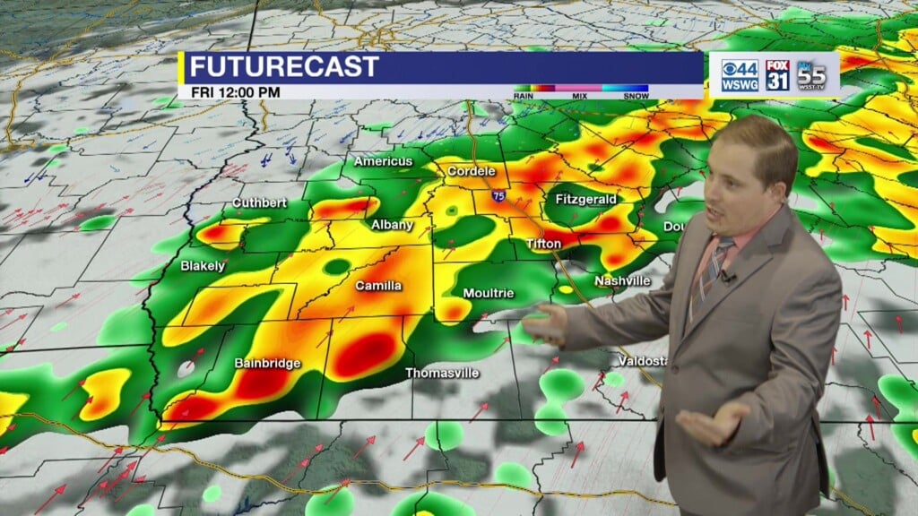
Still, the expectation is for tropical storm force gusts could be as high as 50 mph or greater from the expansion of Ian’s wind field as it slows to a crawl northward mainly on Friday pm-Saturday am.
Shifts in the storm’s track and motion will alter the timing of the earliest reasonable arrival of the tropical storm conditions.
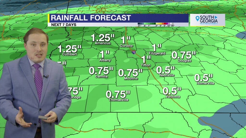
Storm total rainfall forecast has also decreased slightly to 2″-4″ of rainfall, but that could change depending on Ian’s structure, speed of forward movement, and track.
ALL of the above is subject to change, and is highly dependent on the track and timing of Ian. Stay tuned for updates!
Reasonable worst case scenario for the wind gusts (GFS model)
Reasonable worst case scenario for storm total rainfall (NWS Weather Prediction Center) as the storm slows to a crawl as it moves inland. The heaviest swaths of rain will be east of the center of circulation, which is highly dependent on the track.
7 DAY FORECAST
For updates on the tropics from the National Hurricane Center visit hurricanes.gov
WEATHER WATCHERS
If you love talking about the weather, we would like to hear from you! Now you can sign up to become a South GA Television Weather Watcher!
Click the Weather Watchers link at the top of southgatv.com to find out more, let us know you’re interested, and become part of the team!
Matthew Crumley
@MattSouthGATV
Because Local Matters!


