Hurricane Zeta remnants expected to blow through Georgia
Hurricane Zeta Update 10/28 1130 AM (Pics courtesy US National Weather Service)
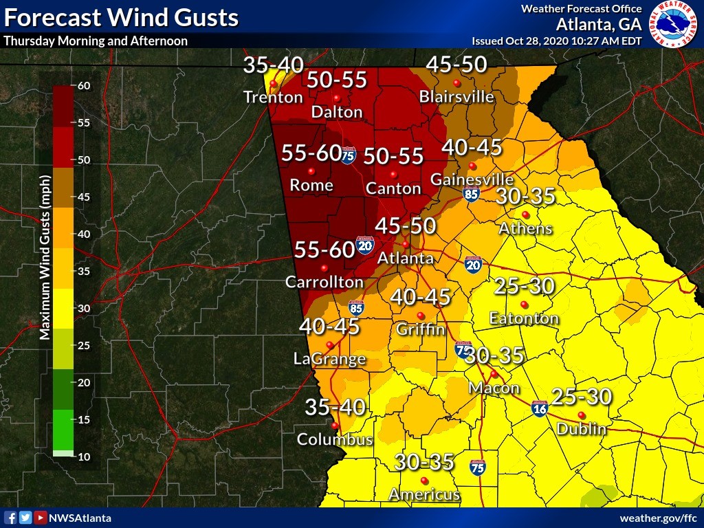
Tropical Storm Warnings have been issued for Georgia, generally along and to the north of I-85. The core of the storm is forecast to pass over the area beginning around midnight Wednesday night into the early morning hours Thursday, according to the National Weather Service.
Primary concerns at this time for these areas are:
- Wind threat – with saturated soils and many leaves still around, some tree damage will be possible with any falling trees or limbs creating power outages and potentially damaging property.
- Flash Flooding – heavy rainfall will occur ahead of the system tonight into the morning hours. Soils are saturated and many plants and grasses are going dormant, so water will move quickly into streams, rivers, creeks and other drainage basins. Don’t drive through fllooded roads. We have seen multiple instances this year of roads being washed away by flood waters this year.
Beyond that, Georgia has a low tornado threat as is the case with any landfalling tropical system. Any tornadoes would be brief and weak.